Don Si Non intersection, Nong Bua subdistrict, toward Ban Pho
Vehicle restrictions / difficult passage
Updated Sun 4 Oct 2026 10:008RIEW
The same summary used for speech playback, available without sound
All help channels, including text and sign language servicesChoose a brand, then choose a district
Reports may remain in their original language.
Back to noticesRoads and travel · Chachoengsao
Newest reports appear first. Select a report for details.
Latest updates from every category
Vehicle restrictions / difficult passage
Updated Sun 4 Oct 2026 10:00Use caution
Updated Sat 3 Oct 2026 22:20Last synced Tue 6 Oct 2026 06:00
No automatically collected reports are available yet. Review local reports below and verify conditions before travelling.
Subdistrict: Nong Bua District: Ban Pho
Vehicle restrictions / difficult passage · Latest available information · Awaiting current confirmation
At 10:00, standing water and heavy, slow-moving traffic were reported. Allow extra time, reduce speed, and check the latest status before travelling.
Latest observation Sun 4 Oct 2026 10:00
Subdistrict: Nong Bua District: Ban Pho
Use caution · Latest available information · Awaiting current confirmation
At 22:20, water was reported entering the area. Vehicles could still pass, but water was rising and approximately 10–20 cm deep. This was a point report at the stated time.
Latest observation Sat 3 Oct 2026 22:20
Awaiting source verification · Approximately Sat 3 Oct 2026 11:00
Road conditions may have changed. Check before travelling.
District: Ban Pho
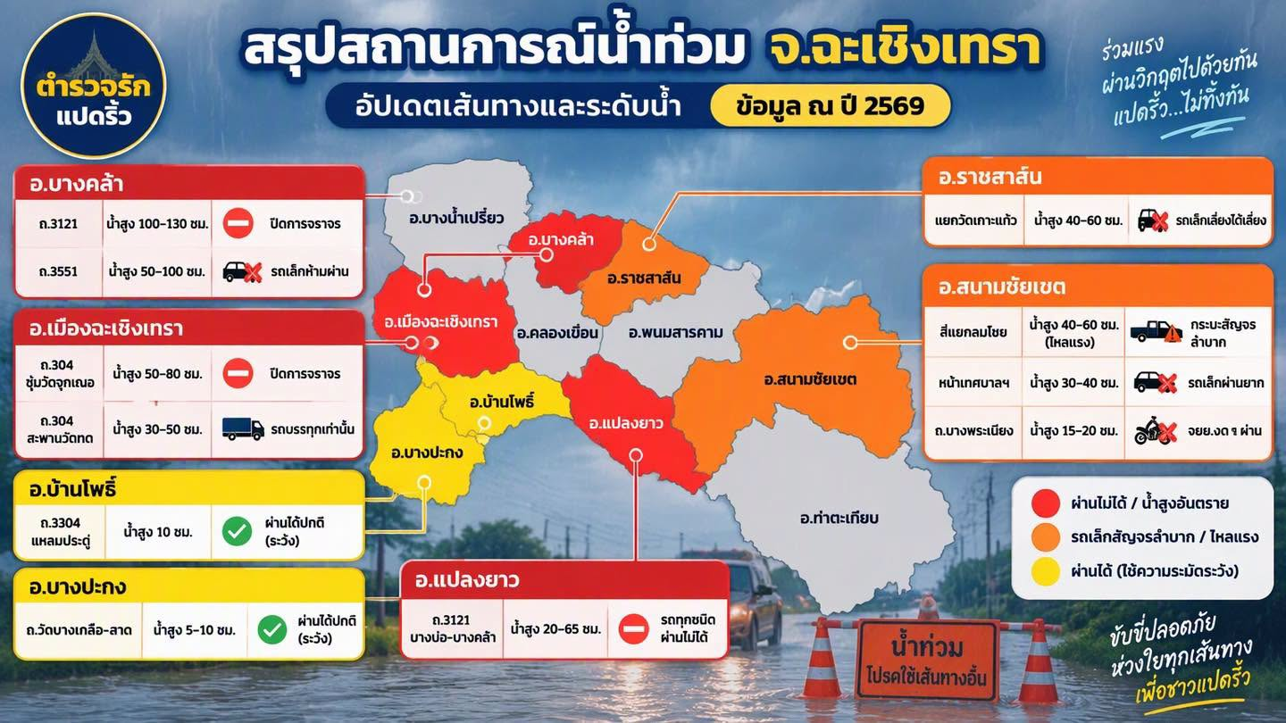
Latest available status: Passable with caution · Awaiting current confirmation
Passable with caution
Reported water depth 10 cm
Approximately Sat 3 Oct 2026 11:00 · As stated by the sender
This record does not yet include the latest closure or reopening notice.
Subdistrict, coordinates, kilometre markers and traffic direction are unconfirmed. Do not use this to choose a detour or determine whether vehicles can pass.
Reference images and timesApproximately 11:00 on 3 Oct 2026, based on information supplied by the user. The original image shows only the year 2026 and does not state a date or time.
Image colours are the creator's grouping. They do not represent current district-wide risk.